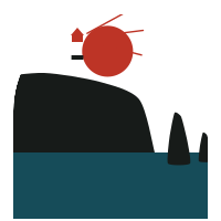
Ponta de São Lourenço
Caniçal · Machico
Eastern headland of Madeira in the parish of Caniçal, municipality of Machico
The Ponta de São Lourenço is the long, narrow eastern headland of Madeira in the parish of Caniçal, said to be named after the caravel São Lourenço, with a lighthouse on its islet. The Elucidário describes its geology, seasonal vegetation, islets, fossil calcareous bodies at Piedade, land snails and use as pasture. The steamer Forerunner sank there in 1884, and a submarine bank lies between it and the Desertas.


1Mentioned in
- Caniçal (parish) — Eastern headland of Madeira within the parish, with a lighthouse on its islet.
- Salt pans — Its strong winds are cited as evidence for good evaporation conditions.
- Our Lady of Pity (chapels) — Headland from which the chapel is visible.
- Pilgrims’ houses — Location of the Piedade chapel and its former pilgrims' house.
- Rocha Furada — Peninsula where Ponta do Furado lies.
- Embate — Sailing ships pass between this point and the Desertas, taking a south-westerly course to reach Funchal.
- Shipwrecks — Where the steamer Forerunner sank in 1884.
- Soundings — A submarine bank lies between it and the Desertas.
- Travessa do Porto Santo — Eastern headland of Madeira from which the Travessa is measured.
- Calcareous bodies of Piedade — Eastern headland of Madeira on which the Piedade site lies.
- Discovery of the archipelago — Point rounded by the caravel São Lourenço and named after it.
- Furado (projection) — Nearby headland.
- Branca (islet) — The headland near whose northern coast the islet lies.
- Boqueirão do Furado — Headland on one side of the channel.
- Boqueirão Grande — Headland where the passage lies.
- Abra (cove, landing place, point and locality) — Eastern tip near which the bay lies.
- Selvageira (Sideritis massoniana) — One of the places where the selvageira grows.
- Limonite — Locality where limonite concretions occur.
- Rock samphire (Crithmum maritimum) — Locality where it has been found.
- Machico (town and municipality) — Headland with a lighthouse sheltering Machico bay to the east.
- Desembarcadouros (islet) — The eastern headland of Madeira, of which the islet is considered part.
- Sea distances — Eastern tip of Madeira used as a reference point.
- Badajeira — The headland near which the shoal lies.
- Headlands — Principal headland of Machico, with several secondary points.
- Margaça — Anthemis cotula grows on this eastern headland.
- Algae — Headland near which large Laminaria saccharina, Sargassum and Liagora are found.
- São Lourenço (point) — Target of this cross-reference.
- Norte da Ilha — Eastern limit of the northern coast.
- Ilhéu Chão — The eastern point of Madeira, separated from the islet by a navigable channel.
- Islets — Headland near which several islets lie.
- Ruivo (peak) — Long eastern point visible from the summit.
- São Lourenço lighthouse — Eastern point of Madeira, named after Zarco's ship, off which the lighthouse stands.
- Madeira archipelago — Eastern tip of Madeira where the Ilhéu de Fora lies.
- Madeira (relief: slopes, plateaux and valleys) — Eastern end of the central range and the longest headland.
- Costa do Sul (southern coast) — Eastern limit of the south coast.
- Lighthouses — Proposed site of a revolving lighthouse in 1861.
- Penedo do Saco — Peninsula where the rock is located.
- Costa do Norte — Eastern end of the north coast and of the island.
- Machico (parish) — Headland rounded by the discoverers before reaching Machico.
- Hay — Produces the best hay in Madeira.
+27 more
2Chronology
-
Passing Ponta de São Lourenço, the caravel São Lourenço approached Machico bay.
-
The British steamer Forerunner was wrecked on the Badajeira shoal off Ponta de São Lourenço, killing three passengers and eleven crew.
-
Madeira's deputies presented a bill for lighthouses at Ponta de São Lourenço and the Pontinha islet, which failed.
-
The São Lourenço lighthouse on the Ilhéu de Fora was lit for the first time.
-
The steamer Forerunner sank off Ponta de São Lourenço, with 14 people killed.
-
Wind direction observations were made at Ponta de São Lourenço.