Girão (cape) 1Name and height of the cliff
Girão (cape)
Original title: Girão (Cabo)
Cabo Girão is a sheer sea cliff on Madeira's south coast, some 600 metres high and among the tallest in the world, named according to Frutuoso as the end of the first day's circuit of the discovery voyage. The entry covers the name, the viewpoint built around 1935 and a public works director's account of its height.


1Name and height of the cliff
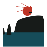
Some have remarked how inappropriate it is to use the word ‘cape’ (cabo) for this towering cliff, which drops sheer into the ocean. Looking at the map of this island, we can make out no projection or tongue of land there that would justify the name, and this becomes still clearer when one travels along the coast, or even when one takes in the cliff along its greatest extent from its highest and most prominent point. Frutuoso seems to give it the name cabo to signify the end (termo) of the first stage of the original maritime exploration, and the name Girão because the circuit (giro) of the first day of that same exploration ended there. To justify the name cabo further, the chronicler refers to a point that the cliff formed below, a point that almost escapes the observer’s notice and can in no way deserve the name of cape. The Saudades say: ‘…they saw a very high cliff close by, and the sea breaking upon a point which it formed below, which became for them the goal and end of their discovery, and they gave it the name of Cabo de Gyrão, because it was on that occasion the last part and end [cabo] of the circuit [gyro] of their course’.
As a cliff overlooking the sea, several authors state that it is among the highest and sheerest to be found anywhere in the world. From some of the highest and most prominent points of that gigantic escarpment, one sees the ocean waves breaking at the foot of the sheer cliff some 600 metres below. That is why countless Portuguese and foreign works contain frequent references to the cliffs of Cabo Girão, which amply reward the scholar and the tourist with a subject for close and lengthy observation. Access to the highest points of the cliff is neither easy nor comfortable, for want of a good road leading there. A branch road 800 metres long is planned, to link these points with the national road that crosses the parishes of Quinta Grande (‘large estate’) and Campanário (‘bell tower’). (1921)
Around 1935 or shortly afterwards, the road was connected to the top of the cliff of Cabo Girão, and a fine viewpoint was built there, which has been widely visited by Portuguese and foreigners alike. From this spot a vast and astonishing panorama unfolds, in which the enraptured eye ranges from the beautiful amphitheatre of Funchal to the parishes of the municipality (concelho) of Ponta do Sol (‘point of the sun’).
2An engineer's account
In the report of a former director of district public works in Madeira we came across a curious account of this well-known point on our coast. We transcribe part of it here, for the interest it may perhaps hold for some of our readers.
At Cabo Girão there is a sheer drop to the sea of 633 metres, a magnificent height not easily found anywhere else on the globe. While surveying the royal road from Funchal to São Vicente, I passed along the top of Cabo Girão and confirmed by levelling that this altitude was true. I wanted to experience the impression I would feel on contemplating the spectacle of so great a height, for I had heard it said, with astonishment, that English tourists would sit there on a projection of the ground, dangling their legs over the abyss. I timidly approached the edge of the cliff and noticed that the sight of such a height made no impression on me at all! The reason was simple: below lay the sea… the sea stretching as far as the eye could see, an immense plain without a single point of reference to make me aware of the great height at which I stood. My fellow workers doubted that the height could be so great, when a chance occurrence allowed me to prove to them that I had not misled them. Directly below that height, down on the sea, was a boat fishing close to the shore. The boat could be seen, very small and completely empty. I had found a point of reference. In the boat there were men who could not be seen, because at a vertical distance of 633 metres it is difficult, if not impossible, to see with the naked eye the horizontal projection of a man, which is little more than the surface of a hat…’.
In this article
Time
Years mentioned · 01Place
Places mentioned · 07- Girão · Subject
Câmara de Lobos
Cabo Girão is a sheer sea cliff on Madeira's south coast, about 600 metres high and among the tallest in the world. According to Frutuoso, its name marks the end of the first day's circuit of the discovery voyage. The entry also records a viewpoint built around 1935 and a public works director's account of the cliff's height.
- Cabo Girão
Câmara de Lobos. The subject of the entry, a sheer cliff about 600 metres above the sea.
Sheer sea cliff about 600 m high (listed at 589 m) and a recommended viewpoint. Its cliffs contain dykes, and it is one of only two places where C. dissectum grows. A rockfall from it killed Henrique Alemão in his boat.
- Campanário
Ribeira Brava. Parish crossed by the national road near the cliff.
Campanário is a parish in Madeira, formerly part of Câmara de Lobos and later joined to the municipality of Ribeira Brava, drained by the Ribeira do Campanário (or da Lapa). The Elucidário records its landing, its band, its capitania-mor, its tithes paid to the Jesuits, a former chapel of St John founded in 1728, and the vicar sentenced by the Alçada of 1823. It was also the birthplace of Bishop D. Manuel Joaquim Gonçalves de Andrade and the jurist Francisco Justino Gonçalves de Andrade.
- Funchal
Visible from the viewpoint as the eastern end of the panorama.
The capital of the archipelago and seat of the principal captaincy, where settlement began; it was made a vila c.1451–52. Its bay, the widest in the archipelago, lies between Ponta do Garajau and Ponta da Cruz and offers sheltered anchorage, though its harbour had never been studied oceanographically. The Elucidário discusses it as a health resort with climate data and records the January 1906 disturbances, the Danish prince's visit in May 1846 and recent volcanic cones in the area.
- Ponta do Sol
Its parishes form the western end of the view from the cliff top.
South-coast parish and municipality, settled from about 1440 by Rodrigo Enes 'o Coxo'. Its parish church of Nossa Senhora da Luz holds a triptych. The Elucidário also records its quay of 1848, paid for by the council, and the royal visit of 1858.
- Quinta Grande
Câmara de Lobos. Parish crossed by the national road from which the branch road to the cliff top was planned.
Quinta Grande is a parish in the municipality of Câmara de Lobos, named after the largest Jesuit estate, which was sold for 140,000 cruzados. It became a curacy in 1820 and was separated from Campanário as an autonomous parish in 1848, with its seat at the chapel of Nossa Senhora dos Remédios, whose feast is celebrated there. It became a julgado of the Funchal comarca in 1927.
- São Vicente
Destination of the royal road from Funchal being surveyed when the cliff height was measured.
São Vicente is described as the largest and most populous parish of northern Madeira and the seat of the only town on the north coast. The Elucidário covers its settlement, church history, localities and landscape, and the deadly landslide of 1929.
People
People mentioned · 01- Gaspar Frutuoso1522–1591
Sixteenth-century chronicler, author of the Saudades da Terra, who explained the name Cabo Girão as the end of the first day's circuit of the discovery voyage.